NORWOOD GREEN
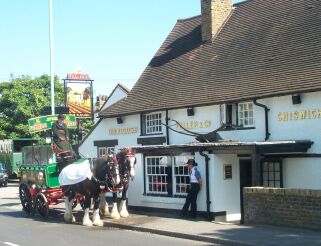
Norwood Green was originally a village in an agricultural area to the west of London. It had a tree lined village green, a village pub, The Plough, dating from 17th century as seen above, and a 15th century parish church dedicated to St Mary the Virgin. The church was extensively restored and rebuilt in 1864 when the tower was added.
The village is just a couple of miles south of Southall beside the Grand Union Canal. It remained largely agricultural during the 19th century, the population being about 2,700 in 1851 and 4,500 by 1861. There were four lunatic asylums in the area at that time. Later the local agricultural fields were turned over to brick fields and brickworks were established beside the canal.
Today the village retains its green and there are several listed buildings in the conservation area, including The Plough public house. Norwood Green has been swallowed up in the London sprawl and is sandwiched between the M4 motorway and the canal. It is only about 4 miles north east of Heathrow Airport, and it borders Osterley Park.
Norwood Green is in the London Borough of Ealing and the Uxbridge Registration District. Parish Registers commence in 1654 and are held at the London Metropolitan Archives
|